Category: news

Practical QGIS – Live Online Class December 7th through 9th, 2020

Learn QGIS

On December 7th through 9th Terra GIS is offering a 3 day online class on QGIS Desktop GIS ( taught live out of, Seattle, Washington). The class will focus on practical exercises in a workshop style setting. The class will enable ArcGIS users to easily transition to using QGIS and its comprehensive tool kit (or to use it in addition to their existing GIS software). Participants can choose to attend the full three days of the class or optionally attend only one or two of the days. Details about the class can to be found here.
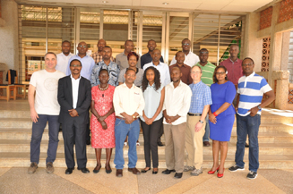
CCRP “Open Source GIS and Tools” Workshop in Nairobi

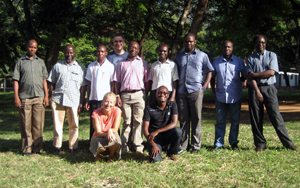
GIS Workshop Photo AICAD 2017

The latest CCRP “Open Source GIS and Tools” Workshop took place from March 20-24th at the African Institute for Capacity Development (AICAD) in Juja town, about 33 km NE of Nairobi. The group of 19 participants included the Kenya GIS team, representatives of the CCRP GIS support teams from Uganda and Ethiopia, and University partners from 4 Kenyan Universities and their attached students. The CCRP GIS support team consisting of Karsten Vennemann and Matt Stevenson had prepared a week long schedule covering a variety of topics with the goal of capacity building within the East African regional GIS support teams. The workshop included lectures and hands on exercises enabling the participants to publish their own interactive web maps, covered QGIS Cartography about ‘how to make better maps’, introduced tools that enable a wealth of spatial functionality using the desktop program QGIS, and finally introduced templates for creating simple maps and graphs by using the statistical software R. One day of the workshop week was dedicated to group work on creating a guide for CCRP researchers on “how to use GIS, spatial tools and analysis” in support of their scientific work and hypothesis. The resulting guide will be refined in collaboration with the research methods team and will be shared with researchers throughout CCRP. The goal of this guide along with the increased GIS support capacity in the region is to enable CCRP researchers to include spatial knowledge and analysis in their research approaches in order to create better results efficiently.

Pre-conference workshop at NWGIS 2016 Conference

Northwest GIS User Group Conference 2016Terra GIS is offering a 2 day hands-on pre-conference workshop “Interoperable Web GIS Solutions with Free & Open Source Geospatial Software” at the NWGIS 2016 Conference – Bridging the Gap. The conference this year will be held at the Salem Convention Center, Salem, Oregon. The pre-conference workshop will be held on Monday October 17th and Tuesday October 18th, 2016, the main conference program will continue until Friday of the same week. Details about the workshop are here and the official conference workshop and registration page is here.

Practical QGIS – Class in Seattle May 28/29, 2015

QGISLogo
At the end of May Terra GIS is offering a 2 day class on QGIS Desktop GIS at the Impact HUB, Seattle, Washington. The class will focus on practical exercises in a workshop style setting. The class will enable ArcGIS users to easily transition to using QGIS and its comprehensive tool kit (or to use it in addition to their existing GIS software). Participants can choose to attend the full two day class or optionally attend only one of the two days. Details about the class can to be found here.
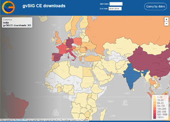
Dynamic Web map of gvSIG CE downloads

Web map of gvSIG CE downloadsFor some time I had been wishing to create an interactive web map showing downloads of gvSIG CE over time. This could provide a nice opportunity to learn more about using the Leaflet JS viewer, and dynamically outputting results as GeoJSON, while at the same time providing more detailed insight into the download dynamics of the gvSIG CE project over time. The idea was to create a map that provides for custom styling and has query capability of the download statistics by country and time intervals.
The software downloads of gvSIG CE are hosted on Sourceforge. Sourceforge also supplies an API for retrieving download statistics for any of their hosted projects – see . The technical steps taken to create the new gvSIG CE download map are as follows: On a server that already had a complete software stack of OS GIS web mapping components installed I created a new PostGIS data base. A simplified Countries (of the world) GIS layer was imported and additional tables to hold the gvSIG download data and summaries created.
Next a way to load the gvSIG CE download statistics into the PostGIS was needed. This was implemented via a custom Python script that can retrieve the data from the Sourceforge API ( automated via a server cron job ) on a daily basis. To obtain all existing data for each day the script had to run separate API calls for each day from the initial start of downloads on August 30 2011 up to today. The Python script then creates a temporary SQL file on the server file system that includes the SQL insert commands for creating the download records in the PostGIS table. Executing the SQL commands in the SQL file in the data base a separate record will be created in that table including the number of downloads for each country and day. For example if on a specific day there where one or multiple downloads from 4 countries then there would be 4 new records added having the countries names, and respective number of downloads along with the download date. Next the web page for the web map was created using a Leaflet based GIS viewer (a Java Script library). The simple Country layer in GeoJSON format was added to Leaflet and some nice, third party base map tiles (in gray scale from www.toolserver.org/tiles/bw-mapnik/ ) added to the map view. In PostGIS the download data was then summarized and joined to the Country geometries in a data base view. The contents of this data base view where exported as GeoJSON and saved as a static java script file and included as a layer in the Leaflet map.
The map at this stage showed the (static) total number of downloads for each Country from the start of downloads to today, however this did not include any query capability. To implement query capability some additional steps are needed: in the GUI two data selection HTML fields for start and end date where added along with a query button. When a user clicks the query button a PHP on the server will be called with the query dates. The query logic is a moderately complex SQL query that summarizes the download data for the selected time period, joins the results to the Country PostGIS layer geometries and then outputs the results as GeoJSON dynamically. Consequently for each query those countries that have had no downloads for the queried time period will not appear in colors in the GeoJSON result layer. In essence the dynamic query replaces the static java script file with the country geometries and total download statistics we added initially.
The draft map that resulted from this work can be found at http://gvsigce.terragis.net. At first glance the most interesting thing is that the top three countries are Spain followed by China and Germany in number of total downloads.

Trans-SEC Web GIS workshop in Morogoro, Tanzania

transsec
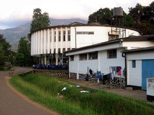
The Web GIS workshop was organized in a cooperation between Sokoine University of Agriculture (SUA), Tanzania and the University of Hohenheim, Germany. Last week my friend and fellow Soil Scientist Dr. Ludger Herrmann and me met at SUA in Morogoro, Tanzania to jointly lead this 3 day workshop for the Trans-SEC project working on food security in eastern Africa. Ludger had been my boss during my first job from 1998-2000 at the University of Hohenheim, Department of Soil Science and Land Evaluation, but we had not worked together professionally since then. transsec
The long name of Trans-SEC is Innovating Strategies to safeguard Food Security using Technology and Knowledge Transfer. Over the next 3 years I will work together with Ludger and our partners at SUA, a team of scientists lead by professor Siza Tumbo. My role will be to teach and support the team implementing a Web GIS platform (based on Open Source GIS software) for use in the Trans-Sec project and to publish an Atlas of Food security of Tanzania.

During this first workshop participants where introduced to MapServer, OpenLayers and PostGIS and we build some first temporary web maps together on a temporary web server. On the second last day of the workshop the server that was shipped from Hohenheim arrived in Morogoro by bus and was then installed on the last day of our stay at the computing center at SUA with help from the IT department. Ludger and I will return for two more web mapping workshops over the next two years to support the project and its mapping components.


gvSIG CE and Sextante workshop at the 2012 WAURISA Conference

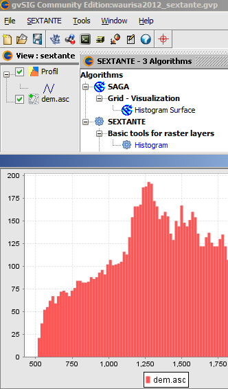
Introduction to gvSIG CE and geo-processing with SEXTANTE
gvSIG CE & Sextante
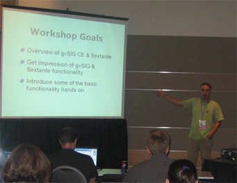
Terra GIS is offering a 4 hours introductory class/hands on workshop about gvSIG CE desktop GIS and Sextante at the WAURISA Conference in Tacoma on Monday May 7th, 2012, 1pm – 5pm.
gvSIG is a powerful desktop GIS system that is known for having a user-friendly interface, being able to access the most common data formats, both vector and raster ones. It features a wide range of tools for working with geographic information (query tools, layout creation, geo-processing, networks, model builder, etc.) and provides excellent cartography and spatial analysis tools, and a wide range of spatial database connectivity. gvSIG CE is the open and international version that has many extensions such Sextante (raster and vector analysis), Raster and Remote sensing, and Network analysis natively integrated.

Preparations and downloads for workshops participants:
Prior to the workshop please download and copy to your system the gvSIG CE software and the workshop data using the links below. Note that Java is needed to run gvSIG and Sextante and is included in the gvSIG CE download for Linux and Windows, but is a separate download for some Mac operating systems .

  • gvSIG CE
  • workshop data (zipped file, unzip to your hard drive)
  • Update Monday May 7th:

  • workshop slides (PDF)
  • Picture from the workshop at WAURISA:
    WAURISA 2012 - gvSIG CE workshop picture
    More information: Please contact us via email or call 206 905 1711 if you have additional questions

    Sextante everywhere

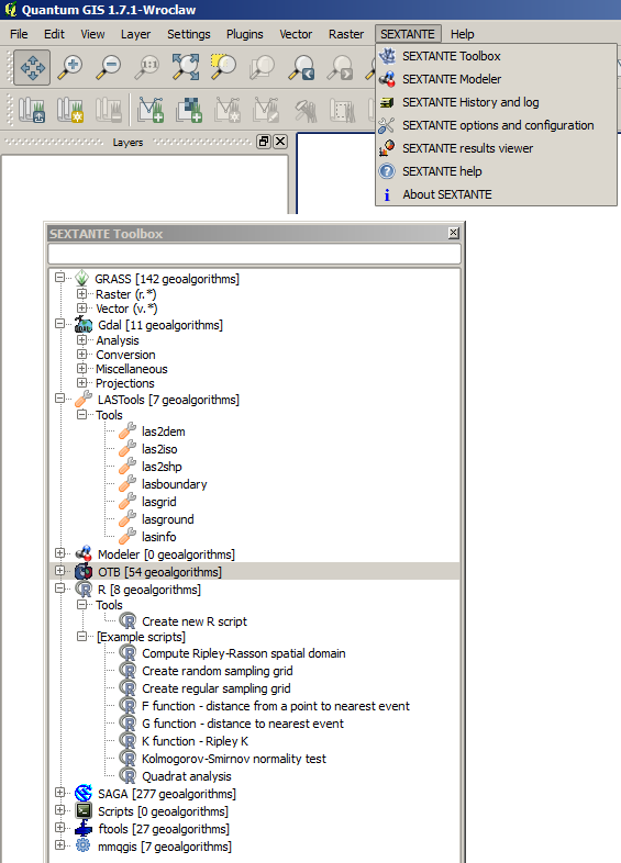
    After the geo-processing library Sextante Sextante toolbox in QGIS was made available for gvSIG, gvSIG CE, and for ArcGIS, a plugin for QGIS was released by Victor Olaya in cooperation with the QGIS community. Now the Sextante toolbox truly has the potential to become the most comprehensive and widely used GIS geo-processing tool that runs on almost any software platform and in almost any GIS software 🙂 . Congratulations Victor and QGIS community !
    Sextante toolbox in QGIS
    For the plugin a rewrite of Sextante algorithms in python is being developed and will take some time to be completed. Currently the Sextante toolbox in QGIS provides access to Grass, Gdal, LASTtools, Sextante Modeler, OTB tools, R, SAGA, fTools and mmqgis. Lots more to come in the next months !


    Micuenca project workshop – San Salvador

    Terra GIS and Catholic Relief Services (CRS San Salvador office) joint forces for a three day long workshop to develop an interactive Web GIS for the GWI (Global water Initiative) Micuenca project (Integrated Watershed Management in Latin America).
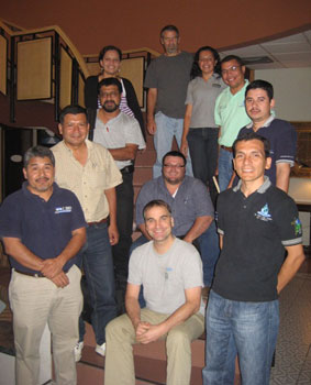
    Group Picture - Micuenca Workshop San Salvador, Dec 2011
    Project Coordinator Paul Hicks (CRS) , Norma Minero (CRS) and Karsten Vennemann (Terra GIS) jointly lead a workshop with participants from each of the 4 countries in the Micuenca project: Nicaragua, El Salvador, Guatemala and Honduras. Two representatives for each of the countries attended the workshop. As a group we jointly defined and started building the functionality of the Micuenca GIS Viewer. Finally all where working in small groups to assemble and edit data for use in the Web GIS and data base.

    CSGIS and Terra GIS collaboration

    This week Ruth Schönbucher from our Partner CSGIS CSGIS(Munich / Immenstadt, Germany) joined the 3 day class Interoperable Web GIS Solutions with Free and Open Source Geospatial software as a class assistant. Dec 2011 OS Web Mapping Class picture
    The class was taught in Seattle at Office Nomads on Capitol Hill, October 3rd through October 5th, 2011. Ruth wanted to to renew her Open Source Web GIS skills (having written a MapServer book some years ago). We are sure that this will be the start for an intensive business partnership and GIS knowledge exchange between CSGIS and Terra GIS.